Chiricahua National Monument
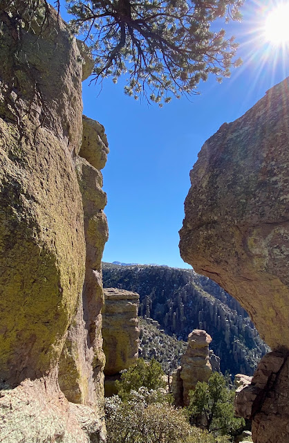
The Chiricahua Apaches called this the "Land of the Standing Up Rocks"
An eruption of the Turkey Creek Volcano spewed ash over 1200 square miles. The superheated ash melted and formed layers of gray rock called rhyolite.
The whole area has such interesting rock shapes, and the drive to the top of the mountain goes thru all types of terrains.
So many different views along the walk at the top.
Lots of moss covered rocks on the north side of the mountain.
A great view point lookout - can see for miles.
Interesting rock shapes-
Name it what ever you think it should be called.
This area could be a great place to return for camping and hiking
(when the weather is warmer!)
Fort Bowie - National Historical Site
"Guardian of Apache Pass"
Apache Pass is half way between El Paso and Yuma. Because the springs were an unfailing source of water, it drew emigrants, prospectors, and soldiers to this Apache homeland. For over 20 years this was the scene of bitter struggles with the US Army and the Apaches for control of the area. It ended with the surrender of Geronimo in 1886.
The Fort was used between 1862 and 1886.
When Geronimo surrendered, there was no need for the Fort to be maintained,
so it was abandoned in 1894 there were 38 buildings.
What you see here are the remains.
Original materials of rock and adobe for walls
The Visitor Center - lovely but
lacking the checker boards like Cracker Barrel
Interesting to see how they communicated then.
Lou thought he would walk in the footsteps of Geronimo.
Notice the mountain in the background of both pictures.


No comments:
Post a Comment